Statistikk innhold
Statistics on
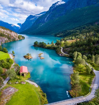
Land use in urban settlements
The statistic describes land use and land cover within urban settlements, in Norway. Areas that are built-up are classified according to usage, while non-built-up areas are classified according to land cover.
Selected figures from these statistics
- Land use and land resources, by category and urban settlement size, 1st January. Per centDownload table as ...Land use and land resources, by category and urban settlement size, 1st January. Per cent
2025 200- 19 999 residents 20 000- 99 999 residents 100 000 or more residents Residential areas 38.2 41.8 40.7 Industrial, comercial and service areas 10.4 10.3 10.0 Road 13.8 15.3 17.1 Other built-up areas 19.1 16.8 17.6 Forest 10.2 10.9 9.2 Agriculture 4.8 2.3 2.0 Other undeveloped areas 3.5 2.5 3.6 Explanation of symbolsDownload table as ... - New buildings, by land resource built on, and distance to existing urban settlement. 31st DecemberDownload table as ...New buildings, by land resource built on, and distance to existing urban settlement. 31st December1
2024 Within delimitation of last year's urban settlements1 In expansion between last year's and current urban settlement delimitations Within 1 km from current urban settlements Between 1-3 km from current urban settlements More than 3 km from current urban settlements Total 8 315 1 411 1 555 1 758 4 674 Fully cultivated land 608 217 109 147 239 Not fully cultivated land 93 86 64 84 194 Forest 1 329 788 569 610 1 959 Open firm ground 427 173 156 164 613 Bogs 39 26 14 16 69 Bare rock, gravel and blockfields 2 1 23 12 18 Inland waters 6 1 0 0 3 Built-up area, roads etc 5 811 119 620 725 1 579 1Defined Land resource Type "before development" is the registered status 10 years ago. This can differ from the actual status before devolopment Explanation of symbolsDownload table as ...

About the statistics
The information under «About the statistics» was last updated 21 November 2025.
Land use
Land use describes built-up areas by socio-economic purpose, and covers for example areas used for dwellings, business, recreation or roads.
Land resource
Collective term for non-built-up areas classified by soil type. The land resource type describes the land surface (soil conditions and vegetation) and its suitability for cultivation and natural plant growth.
Built - up area / site
All types of buildings, structures and permanently sealed surfaces and associated areas.
Non - built - up area
Areas/regions without a permanently built-up surface, including cultivated land.
Urban settlement
A cluster of buildings shall be registered as an urban settlement if it is inhabited by at least 200 persons. The distance between the buildings should normally not exceed 50 metres, but for some space-demanding building categories - such as apartment buildings, industrial buildings, offices / commercial buildings, schools, hospitals etc. - the distance can be increased to 200 metres. Adjacent built-up and constructed areas, such as parks, sports facilities and industrial areas, should be part of the urban settlement. Building clusters with at least 5 commercial buildings or 5 residential buildings are included up to a distance of 400 metres from the urban settlement core.
Name: Land use in urban settlements
Topic: Nature and the environment
Division for Housing, Property, Spatial and Agricultural Statistics
Urban Settlements, Urban Settlements by size-group
Annual
Not relevant
Collected and revised data are stored securely by Statistics Norway in compliance with applicable legislation on data processing.
Statistics Norway can grant access to the source data (de-identified or anonymised microdata) on which the statistics are based, for researchers and public authorities for the purposes of preparing statistical results and analyses. Access can be granted upon application and subject to conditions. Refer to the details about this at Access to data from Statistics Norway.
The first area accounting system of Norway was published in 1981. Aerial photos were used for interpreting land use and land cover. The method was time consuming and was abandoned after the test period.
The establishment of the National register of Ground, Addresses and Buildings (GAB) gave new possibilities for land use statistics. Methods were developed and statistics produced by Engebretsen (1989, 1993).
Automatic digital methods for the delimitation of urban settlements were conducted (Dysterud et al. 1999) and methodical studies of land use statistics were carried out (Engelien 2000, Bloch 2002). In 2005 Land use in urban settlements, based on point datasets and buffer methods, were published. This attempt was not repeated.
By 2011 the available data and the method of delimiting areas had improved immensely, and the method described below was developed. The most important improvement was the use of property boundaries from the Cadastral register and the nation wide land resource map (AR-STAT) from the Norwegian Forest and Landscape Institute. Statistics on Land use in urban settlements based on theese accurate data was first published in 2011, then yearly since 2013.
The statistics is mainly used by civil administration (ministries, directorates, county- and municipality administrations) as well as for research purposes.
No external users have access to statistics before they are released at 8 a.m. on ssb.no after at least three months’ advance notice in the release calendar. This is one of the most important principles in Statistics Norway for ensuring the equal treatment of users.
The statistics area based on the same maps used for the Land use statistics for Norway. Several other statistics are based on the same maps.
The statistics are developed, produced and disseminated pursuant to Act no. 32 of 21 June 2019 relating to official statistics and Statistics Norway (the Statistics Act).
Not relevant
-
The statistics comprises all the urban settlements of Norway according to the Statistics Norway's definition. Stastics Norway's Statistics page for urban settlements : Population and land area in urban settlements
Stastics Norway's Statistics page for Land use and Land cover : Land use and land cover
The land use delimitation includes multiple data sources, the most important are:
- land resource map, AR-STAT, from the Norwegian Forest and Landscape institute.
- buildings and property boundaries from the Cadastre (the National Mapping Authority).
- various data from the public map database (FKB).
- roads from the National roads database - Vbase.
Editing is defined here as checking, examining and amending data.
Based on maps, registers and the use of GIS.
Data revised by owners of the registers, e.g. Statistics Norway and Norwegian Mapping Authorities.
Several digital maps are processed in a GIS-system and classified according to the Classification of land use and land cover. Automatic routines for delimiting and classifying areas has been developed.
The nationwide land resource map ( AR-STAT) from the Norwegian Forest and Landscape Institute forms the basis of the new map. Built-up elements are placed higher in a hierarchy as shown below:
- Road
- Railway
- Rivers and lakes
- Airports
- Greenhouses classified as cultivated land
- Buffered buildings on parcels found in FKB land use
- FKB land use
- Built-up properties or shares of properties
- Buffered buildings
- Sports- and recreational areas
- Data from N50 land cover
- Parking areas
- Ports
- AR-STAT
The finished map is projected from WGS84 UTM 33 to ETRS89-LAEA, and overalyed by Statistics Norway's delimination of Urban Settlements. Areas are calculated and statistics assembled.
Not relevant
Not relevant at present.
The previous method used for delimiting urban settlements gave a zone of undeveloped area at the edge of the urban settlements. This contributed to a high share of undeveloped areas within the urban settlements. The new method, used for the first time in 2013, will in most cases follow the boundary of built-up elements. Undeveloped areas at the edge will no longer be part of the urban settlements, but they will be included if they are surrounded by built-up areas.
The statistics are based on automatic processing of registers and map data bases. The data sources are built up according to national standards, however the interpretations of the standards might differ among municipalities. The completeness in the scope of mapped objects might also differ. This could affect the results, but all in all the results are considered to be comparable from place to place.
For all data sources there will be a time lag from changes in land use appear in reality until they are registered in maps and registries. As long as the time lag is constant it should not affect the result to much.
The numbers for Svalbard are based on different maps and the methods diverge from those used for Norway’s mainland. The lack of property boundaries at Svalbard leads to all buildings being buffered, they are therefore assigned less space than similar buildings on the mainland. For natural resources, the statistics are based on vegetation maps with classes that are not directly comparable with the classes in the Standard classification of land for statistical purposes.
Febr 2019 - New Statistics variable in stat bank table 11441: New buildings, count and utility floor space, by distance to existing urban settlement, building type and area classification (M)
- New Statistics variable : Utility floor space for largest floor, in new buildings (m²)
Febr 2019 - Change made in classification variable "Distance to existing urban settlement" in Statistics table 11441.
All New building are placed in one of four categories, by distance to urban settlements. The naming of these categories was imprecise and somewhat illogical. Naming changed from > to :
1. In existing urban setllement > Within delimitation of last year’s urban settlements
2. In expansion of existing urban settlement >In expansion between last year’s and current urban settlement delimations
3.Within 1 km of existing urban settlement, and not in expansion > Within 1 km of current urban settlements
4. Within 2-3 km of existing urban settlement > Between 1-3 km of current urban settlements
December 2021 - New code in classification variable "Distance to existing urban settlement" in Statistics table 11441.
New category "More than 3 km from existing urban settlement" added. With this addition all new buildings in Norway are covered, as all new buildings will fall within one of the five distance categories. The statistics for all years back to 2014 have been recalculated and include this new category.
December 2021 - Error in method, Statistics table 11441. All statitistics back to 2014 recalculated.
Former calculations did not take into account that a buidling's closest urban settlement could lie within a different municipality. This can give errors in the numbers for categories "Within 1 km of current urban settlements" and "Between 1-3 km of current urban settlements"
The statistics for all years back to 2014 have therefore been recalculated
November 2024 - Older versions used for defining "Area Classification" in Statistics table 11441. All statistics back to 2014 recalculated.
Last year's version of the dataset "Land use" was formerly used to define status for "Area Classification" before development. This is changed, where older versions (up to 10 years old) are now used. All statistics back to 2014 are recalculated. The 2011-version of "Land use" is used for all statistics up to 2021, 2012 for 2022, 2013 for 2023, etc..
November 2025 - Changed method for estimating Building year in Statistics table 11441
The new method is more in line with other statistics from Statistics Norway where buidling year is used. All statistics for table 11441 (back to 2014) are recalculated
The quality of the statistics is highly dependent on the quality of the contents of the Cadastre and various digital maps.
The land resource class ´´Open firm ground´´ in AR-STAT can refer to both built-up and natural areas. The combination with other data sets, like the building register, should assure that the areas are confirmed as built-up. However, in cases where areas are used for storage or industry, but there are no buildings, the areas might appear as undeveloped.
A revision is a planned change to figures that have already been published, for example when releasing final figures as a follow-up to published preliminary figures. See also Statistics Norway’s principles for revisions.
Revisions in previously published seasonally adjusted figures can take place when new observations (or revised previous observations) are included in the basis of calculation. The scope of the revision is usually greatest in the most relevant part (last 1–2 years) of seasonally adjusted time series. A corresponding revision in trends is also typical, particularly at the end of the time series. The extent of the revision of trends and seasonally adjusted figures is partly determined by the revision policy, see Section 4 of the European Statistical System (ESS) Guidelines on Seasonal Adjustment on the Eurostat website. For more information on the revision of seasonally adjusted figures, see the ‘About seasonal adjustment’ section in the relevant statistics.