Content
Published:
This is an archived release.
New figures for basic units
New area figures for basic regional statistical units are now available in StatBank Norway. In addition, statistics on other subjects related to basic units are available as geographical concentrations.
New area figures for land and freshwater have been calculated for basic statistical units. Changes in the figures are mainly due to changes in accuracy and coverage of fresh water in digital maps.
There are no changes in municipality figures. Due to differences in area calculations for municipality figures and basic units, as well as source differences, there are some discrepancies.
The smallest basic unit by area is about 200 square metres (in Bodø municipality), while the largest is close to 1 800 square kilometres (in Guovdageaidnu/Kautokeino). The majority of large basic units are located in Finnmark county. Utsira municipality only has one basic unit, while Oslo municipality has the largest number of basic units with 558.
The mapping of Norway started in 1753. In 1885, the first area figures were published in the first volume of “Land and People”, ordered by the Parliament ten years earlier. The last volume was published in 1920.
How to find figures in StatBank Norway
If you want figures for each single basic unit or all basic units, this has to be done in several steps. Select the right table, and then select the tab called “Select via groups”, then select the option “Region” in the scroll menu “Select variable”. Select one of the groups in the scroll menu below. Click on “Select as single values” when you have selected the basic units. You can now go back to the tab called “My table” and continue as normal.
Figures for population by basic units are found in the StatBank table: 04317: Population, by basic statistical units (BU) (1999-2007)
About basic units
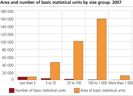
There are about 14 000 basic statistical units and 1 550 statistical tracts in Norway. The purpose of dividing municipalities into basic statistical units was to establish small, stable and geographical units that provide a flexible basis for the work with and the presentation of regional statistics for statistical, analytical and planning purposes.
The basic statistical units are designed to be as stable as possible for a reasonable time period and the units shall be geographically coherent. One main principle is that basic statistical units shall be as homogeneous as possible with respect to communication and building structure, for instance.
The statistical tract is an intermediate level between municipality and basic statistical unit.
About the figures
The area of the basic regional statistical units is based on digital maps of administrative boundaries and calculated by the Norwegian Mapping and Cadastre Authority. Digital maps for administrative areas have been analysed with the geographical overlay of digital maps for coastline, lakes and rivers.
Figures for land and water areas for municipalities and statistical units are available in StatBank Norway. Aggregation of area figures from different geographical levels may result in slight deviations due to simplified area calculations.
See
also
:
Database for standard classifications:
http://www3.ssb.no/stabas/ClassificationFrames.asp?ID=1498751&Language=en
National Mapping and Cadastre Authority:
http://www.statkart.no/
.
Additional information
Contact
-
Erik Engelien
E-mail: erik.engelien@ssb.no
tel.: (+47) 91 12 55 45
-
Jørn Kristian Undelstvedt
E-mail: jorn.kristian.undelstvedt@ssb.no
tel.: (+47) 94 50 68 64